Octave BricsCAD’s land surveying tools take survey teams from raw field data to finished, standards-based drawings without leaving DWG.
Survey teams rarely lose time in the field. They lose it afterward, turning raw observations into clean, coded, drawn-up deliverables, often in a high-cost CAD seat that might only be doing survey drafting and surface work. BricsCAD’s land surveying tools keep that whole process in one place. They take field data through to finished drawings in a single, DWG-native environment: import points from total stations, GNSS/GPS, ASCII files, point clouds and GIS; build and refine TIN surfaces; generate and label contours; and produce topographic, boundary and as-built deliverables.
We asked Octave BricsCAD’s Rita Carone, a specialist in the civil and survey field, to explain how BricsCAD’s land surveying tools work in practice.
8 questions about BricsCAD’s survey toolset, answered
1. What are BricsCAD’s land surveying tools, and what are they designed to help surveyors do?
Carone: BricsCAD’s surveying tools sit in a single DWG-native environment built to take field data through to finished drawings. You import points from total stations, GNSS/GPS receivers, ASCII point files, point clouds, and GIS data; organize them into point groups; build and refine TIN surfaces; generate and label contours; create breaklines and 3D strings; and produce topographic, boundary and as-built deliverables.
Transparent commands let you enter data in familiar survey formats, bearing/distance, point numbers, snapping to point objects, and surveyor-focused drafting tools handle point labelling, line and curve labels, and geometry creation.
The aim is to get from raw field data to an accurate, standards-based drawing without leaving DWG or round-tripping through other software.
2. Who tends to get the most value out of these tools? What kind of teams or workflows are they best suited for?
Carone: They suit land and building survey teams that already work in DWG and need to turn field and scan data into drawings, topographic, boundary/cadastral, and as-built work in particular. The teams that benefit most tend to be those currently paying for a high-cost CAD seat to do what is essentially survey drafting and surface work, those juggling mixed data sources (total station + GNSS + point cloud + GIS) who want one environment, and small-to-mid firms that want survey-specific tooling without a full civil-design suite.
If your workflow is field capture, surface, and deliverable, it’s a natural fit.
3. A lot of survey teams already run on DWG and established field instruments. How do these tools fit into existing data and equipment rather than asking people to start over?
Carone: Because BricsCAD is DWG-native, your existing drawings, blocks, layer standards and templates open and save as .dwg, there’s no conversion layer and no migration to a proprietary format.
On the field side, you import directly from total stations, GNSS/GPS and ASCII point files, and there’s also a direct connection to Leica Infinity software. Point clouds from terrestrial, aerial, or bathymetric LiDAR import from multiple formats.
The intent is to slot into the data and instruments you already run, not to replace them.
4. I work with Leica instruments. How does BricsCAD work with Leica Infinity?
Carone: A lot of surveyors are Leica users, so we built two ways to bring Leica Infinity data into BricsCAD and keep everything in one environment, no exporting to a neutral format and rebuilding the drawing by hand.
The first is Leica Infinity Import. You set your template up once: blocks, layers, and styles. From then on, you just open the Leica Infinity file. The data comes in already “smart”: strings, civil points, TIN surfaces, and other features arrive as intelligent objects carrying their own attributes, so there’s no tidying up or re-styling afterwards. The drawing is ready to work with the moment it opens.
The second is the Leica Infinity Connector, a live link for working alongside an active Infinity project. If a colleague is updating the Infinity project day by day, the technician in BricsCAD is notified whenever something is added or amended and can pull those changes in, so office and field stay in sync instead of passing files back and forth.
5. TIN surfaces are central to so much survey work. What does the workflow look like for creating, refining, and sharing them across drawings?
Carone: You create a TIN surface from points, point groups, breaklines, point clouds, or contour data and BricsCAD can build a surface directly from contours rather than treating them as breaklines, which reduces the flat triangles that contour-only data usually produces. Refining is interactive. Add or remove breaklines, add or weed out vertices, remove outer edges, apply surface smoothing, and label contours, with edits updating the surface immediately.
For sharing, smart referencing lets multiple drawings reference the same surface as a lightweight link, so it can be reused across drawings and updated without duplicating heavy data. But not just that, you can then extract data from TIN surface or convert it, and use our tool volume calculation for terrain analysis.
6. Point clouds can carry a lot of noise. How do the scan-to-TIN tools help isolate ground features and turn LiDAR captures into accurate survey features?
Carone: You import the point cloud, then classify it to separate ground from non-ground returns, vegetation, structures, noise, so the surface is built only from points that represent terrain. From the cleaned data, you generate an optimized, lightweight TIN, and use 3D strings and snapping to capture survey features accurately.
Recent releases also add automatic linear-feature detection, generating lines, polylines, or surfaces directly from the scan instead of tracing everything by hand.
7. Interoperability is a real concern for teams who don’t own every Autodesk product. How does BricsCAD handle Civil 3D data, GIS formats, and LandXML and where does it allow a full roundtrip versus read-only reference?
Carone: It varies by format, and being precise here builds trust rather than overpromising:
DWG, fully native both ways. Geometry opens and saves as .dwg with no conversion.
LandXML, imports and exports, so surfaces, alignments, and points genuinely roundtrip with other packages.
GIS (shapefiles, file geodatabases, KML/KMZ), imports, and exports, including a roundtrip GIS editing workflow inside the DWG.
Civil 3D, the qualified one. You can display Civil 3D objects as proxy references or import and convert them into BricsCAD civil objects for further work, but the intelligent Civil 3D objects come in one-way; there’s no live roundtrip back out as native Civil 3D objects.
In short: DWG, LandXML, and GIS are genuine roundtrips; Civil 3D intelligent objects are reference or one-way import/convert.
8. Looking at the latest release, what improvements stand out as most impactful for surveyors?
Carone: Surveyors don’t lose their time in the field, they lose it afterwards, turning raw observations into clean, coded, drawn-up deliverables. Cutting that post-processing time is what BricsCAD’s survey tools are built for, and it’s where we focus our development. BricsCAD Pro already ships a dedicated Survey workspace shaped around how surveyors really work rather than generic drafting, so the route from field data to finished drawing is shorter and more direct.
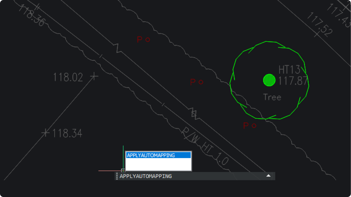
The clearest example is the coded field-to-finish workflow with AUTOMAPPING: set up a template once, import a coded field file from directly from the instrument, and the drawing builds itself, points, labels and blocks placed automatically from the codes. Points have worked this way from BricsCAD V26. V27 will extend it to linework, so coded strings come in as finished lines instead of being traced by hand. Less manual rework, faster to deliverable.
One environment, from field to finish
Carone: The goal of BricsCAD’s land surveying tools is to shorten the route from raw field data to a finished, standards-based drawing, without leaving DWG or round-tripping through other software. Import from the instruments and data sources you already run, build and refine TIN surfaces, clean point clouds down to real ground features, and genuinely roundtrip LandXML and GIS with the rest of your toolchain. For survey teams already working in DWG, it’s survey-specific capability that fits the workflow you have, rather than asking you to rebuild it.
Try BricsCAD V26 for Free
You can explore every new feature for yourself with a free 30-day trial. Get BricsCAD V26 now.
Choosing BricsCAD for your team? As India’s authorized distributor, we provide genuine licenses, priority support, and transparent pricing. Write to hello@exceldesigntechnologies.com or click here to connect with us.